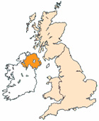
Map of Ballyclare Northern Ireland and Surrounding Areas
Detailed street map of Ballyclare town centre and the surrounding areas, towns & villages.
View Larger Map |
||
 |
||
Ballyclare Map Northern Ireland Showing the Town and its Surroundings
Street Map of the Northern Irish Town of Ballyclare: Find places of interest in the town of Ballyclare in County Antrim, Northern Ireland UK, with this handy printable street map. View streets in the centre of Ballyclare and areas which surround Ballyclare, including neighbouring villages and attractions. Large Ballyclare map.
Places of interest in and surrounding Ballyclare, County Antrim include: Six Mile Water, Ballyclare Branch Library, Ballyclare War Memorial Park, Abbey Real Estate, Market House, Ballyclare Nursery School, The Sportsmans Inn Pub, Fairview Primary School, Ballyclare Comrades Football Club, Ballyclare Secondary School, The Square Ballyclare, Main Street Ballyclare, Sixmilewater Park, Ballyclare Cemetery, Tir-na-Nog Primary School, The B94, Pots of Pleasure Cafe, Ballyclare Post Office, Ballyclare High School, The A57 (Templepatrick Road) and more.
Highlights of This Ballyclare County Antrim Map:
- Easy to Print Map for Town Centre of Ballyclare.
- Get a Satellite View of Ballyclare.
- Find Routes To and From Ballyclare area.
- View Villages and Towns Around Ballyclare.
- Identify Ballyclare Areas of Interest.
- See Ballyclare Housing & Industrial Estates.
- Easily Find Ballyclare Tourist Attractions.
- Zoom in, Pan and Move Around Ballyclare.
- See Rivers, Canals, Lakes and Waterways.
The Post Code for Ballyclare is: BT39
Locate streets and roads in and near Ballyclare, locate interesting places and attractions in and near Ballyclare, locate churches and religious centres in and near Ballyclare, locate hospitals and health centres in and near Ballyclare, locate towns and villages surrounding Ballyclare area.
More Maps of Northern Ireland:
- Map of Coalisland Area & Surroundings N Ireland
- Map of Portstewart Area & Surroundings N Ireland
- Map of Ballymena Area & Surroundings N Ireland
- Map of Dungiven Area & Surroundings N Ireland
- Map of Maghera Area & Surroundings N Ireland
England City and Town Maps | French Places