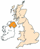
Map of Downpatrick Northern Ireland and Surrounding Areas
Detailed street map of Downpatrick town centre and the surrounding areas, towns & villages.
|
View Larger Map |
||
 |
||
Downpatrick Map Northern Ireland Showing the Town and its Surroundings
Street Map of the Northern Irish Town of Downpatrick: Find places of interest in the town of Downpatrick in County Down, Northern Ireland UK, with this handy printable street map. View streets in the centre of Downpatrick and areas which surround Downpatrick, including neighbouring villages and attractions. Large Downpatrick map.
Places of interest in and surrounding Downpatrick, County Down include: Down Arts Centre, Seaforde Gardens and Tropical Butterfly House, Brendans Bar & Restaurant, The Downshire Hospital, Downpatrick Methodist Church, Eclipse Cinema Downpatrick, Down County Museum, Downpatrick Library, The A25, De La Salle High School, Savages Bar, Market Street Downpatrick, Funky Monkeys Downpatrick, The Quoile River, Downpatrick Nursery School, Irish Street Downpatrick, Dunleath House B&B, Inch Abbey, Down Cathedral and more.
Highlights of This Downpatrick County Down Map:
- Easy to Print Map for Town Centre of Downpatrick.
- Get a Satellite View of Downpatrick.
- Find Routes To and From Downpatrick area.
- View Villages and Towns Around Downpatrick.
- Identify Downpatrick Areas of Interest.
- See Downpatrick Housing & Industrial Estates.
- Easily Find Downpatrick Tourist Attractions.
- Zoom in, Pan and Move Around Downpatrick.
- See Rivers, Canals, Lakes and Waterways.
The Post Code for Downpatrick is: BT30
Locate streets and roads in and near Downpatrick, locate interesting places and attractions in and near Downpatrick, locate churches and religious centres in and near Downpatrick, locate hospitals and health centres in and near Downpatrick, locate towns and villages surrounding Downpatrick area.
More Maps of Northern Ireland:
- Map of Portrush Area & Surroundings N Ireland
- Map of Antrim Area & Surroundings N Ireland
- Map of Enniskillen Area & Surroundings N Ireland
- Map of Holywood Area & Surroundings N Ireland
- Map of Ballynahinch Area & Surroundings N Ireland
England City and Town Maps | French Places