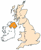
Map of Eglinton Northern Ireland and Surrounding Areas
Detailed street map of Eglinton town centre and the surrounding areas, towns & villages.
View Larger Map |
||
 |
||
Eglinton Map Northern Ireland Showing the Town and its Surroundings
Street Map of the Northern Irish Town of Eglinton: Find places of interest in the town of Eglinton in County Londonderry, Northern Ireland UK, with this handy printable street map. View streets in the centre of Eglinton and areas which surround Eglinton, including neighbouring villages and attractions. Large Eglinton map.
Places of interest in and surrounding Eglinton, County Londonderry include: Lloyds Pharmacy (Chemists), The B118 (Coolafinny Road), Campsie Industrial Estate, City of Derry Airport, The A2, The Manor House Eglinton, Artisan in the Village, The River Faughan, Eglinton Primary School, Eglinton Eyecare, Ashburn Image Beauty Salon, Eglinton Dental Solutions, Connoly's Restaurant, Greysteel and more.
Highlights of This Eglinton County Londonderry Map:
- Easy to Print Map for Town Centre of Eglinton.
- Get a Satellite View of Eglinton.
- Find Routes To and From Eglinton area.
- View Villages and Towns Around Eglinton.
- Identify Eglinton Areas of Interest.
- See Eglinton Housing & Industrial Estates.
- Easily Find Eglinton Tourist Attractions.
- Zoom in, Pan and Move Around Eglinton.
- See Rivers, Canals, Lakes and Waterways.
The Post Code for Eglinton is: BT47
Locate streets and roads in and near Eglinton, locate interesting places and attractions in and near Eglinton, locate churches and religious centres in and near Eglinton, locate hospitals and health centres in and near Eglinton, locate towns and villages surrounding Eglinton area.
More Maps of Northern Ireland:
- Map of Warrenpoint Area & Surroundings N Ireland
- Map of Limavady Area & Surroundings N Ireland
- Map of Comber Area & Surroundings N Ireland
- Map of Coleraine Area & Surroundings N Ireland
- Map of Ahoghill Area & Surroundings N Ireland
England City and Town Maps | French Places